
Soil brightness scanning aids input decisions
A novel way to help fine tune crop inputs has received a cautious ‘thumbs-up’ from two southern growers. Andrew Blake reports
Anyone viewing Google Earth’s relatively low-resolution satellite images will be aware of variations in crop cover within fields. Likewise its shots of bare ground often highlight considerable differences in apparent soil types.
Higher resolution images of growing crops are increasingly used to modify nitrogen inputs. Now the Wiltshire precision farming company, The Courtyard Partnership, believes this more detailed imagery can usefully enhance its well-established soil zoning system.
Zoning allows farmers to highlight areas where inputs such as seed and fertiliser can appropriately be adjusted automatically on the move, explains the firm’s Vince Gillingham.
Soil Brightness Scanning, which he believes is a first commercial offering, allows users of the company’s Intelligent Precision Farming package to make more precise input decisions, particularly on seed rates.
“The brightness scanning works on a 5m resolution to indicate soil texture, organic matter and soil moisture, geo-referenced to produce accurate zones.”
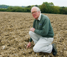
One of the first growers to adopt the brightness scanning idea is Peter King, arable manager at Yattendon Estates near Newbury, Berkshire.
“We first dabbled with precision farming in 1995 when we retro-fitted an RDS yield meter to our combine,” he says.
Over the years several systems have been tried, initially solely to drive phosphorus and potash applications, with varying degrees of success. The latest approach combined information from yield maps with relatively expensive electromagnetic induction (EMI) scanning of some of the 1,700ha of arable land. The results were used to drive nitrogen dressings and seed rates for the main crops of winter cereals and oilseed rape, explains Mr King.
“Eighteen months ago we decided we’d probably got to go for RTK guidance and a more accurate system. I looked around at what was available, particularly liked the IPF idea, and signed up with Courtyard in February 2011.”
Several fields were zoned using a combination of old maps, previous systems’ findings and a visit from the firm’s soil scientist, he explains.
The estate has a wide range of soil types overlying chalk at depths of 30-120cm. They range from clays to sands which dry easily, but the most obvious feature is the stone content, which can be up to 40%.
“The stones have a big effect on everything we do,” says Mr King.
That makes the soil brightness scanning of bare ground in the autumn particularly appropriate, he believes. “It’s much more precise than Google Earth and we can use it to tweak the zones.”
Following a scan of one specific field on 30 September last year, he chose three seed rates – 250, 300 and 340/sq m – for Solstice wheat to take account of the zone differences, the lowest being for what he anticipated would be the most productive soil.
“Our target tiller count is 500/sq m,” he notes. The figures from samples taken on 16 May were 662, 463 & 436/sq m. “That suggests that we could have cut back even more from the 250 rate, but I’m happy with the result.”
Mr King believes the soil brightness scanning should prove especially valuable later this year when he takes in-hand 190ha of land currently in spring crops. “It should be very useful as I don’t know much about it.
“Over the next three to four years, I expect we’ll have the whole arable area zoned, but however we do it it’s important to remember that the zones need ‘ground-truthing’.” That requires in-field visits from Courtyard, he says. “But compared with the EMI approach it’s a lot cheaper.”
Chris Allen farms 1,200ha of clay with flints near Basingstoke in Hampshire. Aided by agronomist Seumas Foster, he is coming to the end of his first season using zone-driven fertiliser and seed rates and making full use of the IPF Toolbox.
“It’s heavy ground,” says Mr Allen. “We can min-till most areas, but still have to plough in places.
“We’re aiming to be more accurate with inputs, save money, reduce waste and increase margins. We chose Courtyard because it gave us the chance to have our own input into the zoning process.”
Both men view soil brightness scanning as enhancing that process.
“We’re slowly doing more as we get used to the system,” says Mr Foster. “And we intend to look at the yield maps this autumn with a view to adopting more variable-rate fertilisers, seed and nitrogen in the spring.
“I’m 100% sure we’re going to save substantial amounts of money.”
