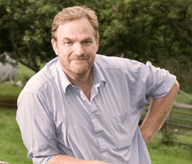
OPINION: Charlie Flindt meets GPS-wielding walkers

It is said that the Ordnance Survey (OS) leaves little mistakes in its maps to stop other cartographers copying its work – I spotted one online recently at SU604276.
But after a long weekend sowing very, very late winter beans in Blackhouse Road, I think there’s another big mistake on the typical OS map. It’s in the small print at the bottom, where all the different rights of way are classified, and there’s a disclaimer saying: “The representation on this map of any other road, track or path is no evidence of the existence of a right of way.”
The thing about Blackhouse Road field is this: it has a splendid view of probably half of the farm’s roads, tracks and paths, as well as other hedge lines and assorted fallow stubbles.
And after a long weekend dragging my 3m drill across 30ha, it’s safe to say that the conventions on rights of way have been thoroughly abandoned. I saw scramblers hurtling irresponsibly along Dark Lane, speeding past the remains of the vandalised sign saying “no motorised vehicles”, and terrifying the horse riders. And then the horse riders gallop up what is only a footpath, and then steer their steeds nonchalantly out into the struggling oilseed rape to avoid getting their hooves mucky in the puddle at the top.
I should, I suppose, have been pleased that they were at least on some sort of right of way. These days, any strip of grass or hedge constitutes a right of way – the OS’s efforts to inform the general public on such matters are completely wasted.
The rights of way small print is a throwback to the days when food production was a priority, and farmers could be more assertive about privacy. Nowadays, we all suffer from a sort of post-grain-mountain guilt that makes us uneasy about saying: “No, you can’t walk here.”
“In a couple of years, when the food shortage becomes common knowledge rather than an odd secret in the trade, and farmland returns to its primary purpose of being somewhere where food is made, we’ll find it easier to steer those lost souls back to the correct path.”
Charlie Flindt
Mind you, I had to stop on that beautiful March Sunday and intercept two walkers who were striding forcefully across Blackhouse Road, miles from the nearest footpath. “Just thought you should know you’re a bit lost; the footpath’s over there,” I said cheerfully.
“No, we’re not lost,” said chief cagoule, with just a hint of aggression. “We’re heading over there, and we’ve got GPS.” At this he brandished a hand-held yellow box.
I’m not often lost for words. I’ve got a smart reply for “But I’m from Bramdean”, “But this is National Trust land”, “It’s not doing any harm” and “Don’t you know who I am?” The last one is particularly common in a part of Hampshire where wannabe lords of the manor outnumber us serfs by about two to one. But “We’ve got GPS” left me floundering. To their credit, they did agree to return to the path.
In a couple of years, when the food shortage becomes common knowledge rather than an odd secret in the trade, and farmland returns to its primary purpose of being somewhere where food is made, we’ll find it easier to steer those lost souls back to the correct path.
However, it could still be a challenge if the Ordnance Survey fails to correct its little mistake at SU604276: it now shows a track that has appeared from nowhere, running not far from the correct footpath. It could be quite a problem convincing someone there’s no track there if it’s there in black and white on the map. I could be rendered speechless again.
Charlie Flindt is a tenant of the National Trust, farming 380ha at Hinton Ampner, in Hampshire.
Read more from all our Opinion writers
