
FOR SALE – Arable land at Orston, South-east Nottinghamshire
POA - SALE
Description
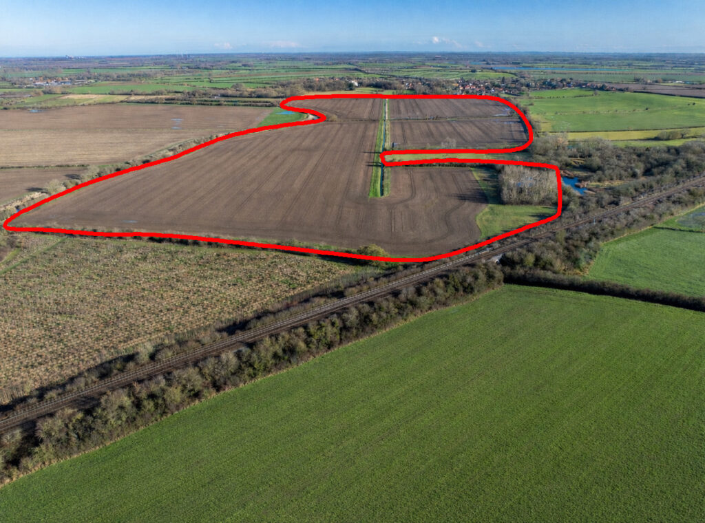
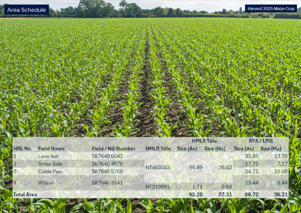
A single block of land comprising c. 37 Ha [92 acres] of Grade 3 soils suited to arable cropping
For sale by private treaty as a whole
Guide Price (Whole): £775,000
92.20 acres | 37.31Ha
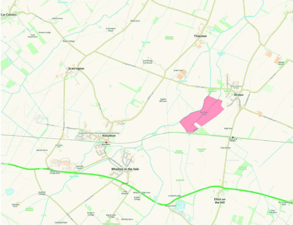
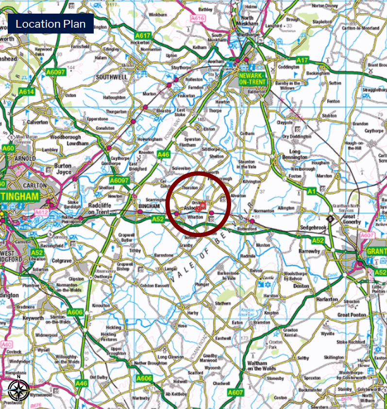
Location ///confused.digesting.sampling
Grade 3 arable farmland More detailed information is available in the farm data room.
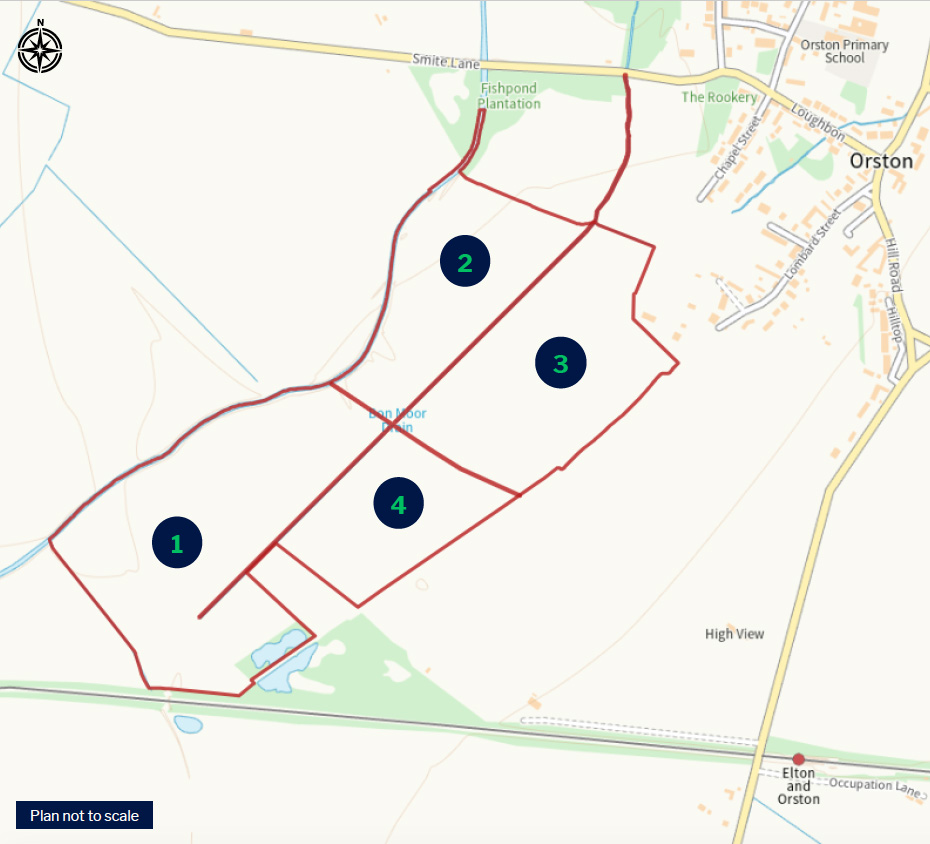
Back Cropping
The back cropping is arable focused with a wide spread of combinable crops grown since the current owners took ownership, including:
Winter/ Spring Wheat Winter/ Spring Barley Peas Oil Seed Rape Spring Linseed Maize
(The full back cropping history is in the data room along with a plan which shows the name of each field.)
Under Field Drainage
Fields 1 [Lone Ash] and field 4 [Willow] have under field drainage. The age and specification varies. Please see the farm data room for the drainage plans and documentation. Field 2 [Smite Side] and Field 3 [Cattle Pen] have limited under field drainage, the location of such drains is unknown.
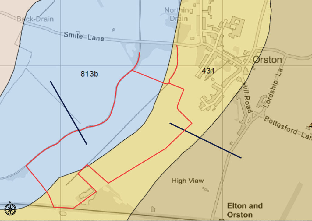
Soil Association – Worcester 431
Slowly permeable non-calcareous and calcareous reddish clayey soils over mudstone, shallow on steeper slopes.
The major landuse on this association is defined as permanent and short term grassland with dairying and stock rearing; some winter cereals in drier districts.
The Soil Site Report from which this data was taken was provided by Cranfield Environment and Agrifood. A full copy of the report is available in the farm data room.
—
General Information
The contents of this section applies to all of the Property unless the text specifically refers to an individual parcel.
Property Area
The overall area of the Property is 92.20 acres (37.31ha) approximately. This is based on HMLR Title Plan areas.
Sporting
All sporting rights are included in the sale of the Property.
BPS | Entitlements
No right to any payments are included in the sale of the land.
Development Overage
The Property is being sold subject to an overage for any nonagricultural use of 35% for 50 years.
Easements and Wayleaves
The land is sold with the benefit of and subject to all existing rights and obligations including rights of way, whether public or private, light, support, drainage, water and other obligations, easements, quasi-easements, and all wayleaves whether referred to or not in these particulars.
Utilities & Services
The Property does not benefit from either a water or electricity supply.
Drainage Rates
Rates are payable to the Trent Valley Internal Drainage Board which for the 12 month period ending 31.03.26 were £535.90.
Access
The Property is accessed via Lombard Street which is maintained at the publics expense or from internal farm tracks which form part of the Property.
Land Drainage
Detailed plans are available in the farm data room for the fields which have under field drainage.
Nitrate Vulnerable Zone
The Property sits within an NVZ – NVZ ID; S317 – NVZ Name; SMITE R NVZ.
Public Rights of Way
The Property is subject to a public footpath which runs along the northern and western boundary. Please see the plan in the data room for the exact location.
Sustainable
Farm Incentive [SFI] Scheme There is an SFI agreement currently in place for part of the Property. This will be withdrawn on completion of the sale.
Tenure and Possession
The property is offered for sale freehold with vacant possession subject to the harvest of maize until 31st October 2026, and the sale completion date
Mines & Minerals
Mines and minerals are included within sale of land registered within HMLR Title Number NT310991. Mines and minerals are excepted and reserved with the provision for compensation for the land registered within HMLR Title Number NT463503.
Rights
The land registered under HMLR Title Number NT463503 contains a provision as to boundary features. Further details are available in the farm data room.
Value Added Tax
If the sale of the land, or any associated rights becomes a chargeable supply in the context of VAT legislation, VAT will be payable by the purchaser[s] at the prevailing rate, in addition to the purchase price.
Location
What3Words – ///confused.digesting.sampling
Plans Areas and Schedules
The property comprises multiple Land Registry titles.
The areas referred to in these particulars are derived from the measured areas of the constituent title parts as downloaded into the Land App and the unregistered areas based on the deeds transferred onto and measured in the Land App. These are shown in the column labelled HMLR Title areas in the land schedule for each field. The LPIS areas on the land schedule are based on RPA data. They are provided for illustrative purposes only.
Boundaries
It will be assumed that the purchaser has full knowledge of all of the boundaries; neither the seller nor their Agent will be responsible for confirming any boundaries or the ownership thereof.
Method of Sale
The Property is offered for sale by private treaty. It is likely, but not certain, that best bids will be requested as part of the sale process, so if you are interested in making an offer, please make sure that you make this known to the selling agents.
Exchange, Completion and Early entry
Following acceptance of an offer, the purchaser will be expected to exchange contracts within 8 weeks of the agreement of Heads of Terms. Completion thereafter will be following the harvest of the 2026 crops. Early entry, if required, will be available post exchange, as harvest 2026 crops are cleared.
Anti – Money Laundering
In accordance with Anti – Money Laundering Regulations, the source of funding and identification will need to be provided by the successful buyer[s].
Viewing
Viewing will be strictly by appointment with the selling agent. Please contact the office to arrange a viewing.
Farm Data Room
Please contact Claire Baker in the office for access: claire@hubrural.co.uk | 01406 370035
Selling Agent [sole]
Hub Rural Ltd, The Crew Yard Pickwell House, Hogs Gate, Moulton, Spalding, Lincolnshire, PE12 6QH. T: 01406 370035 | hub@hubrural.co.uk