
Drones may see opportuntities for farm contractors
Contractors are often the first to try out new technology, for the simple reason that it may well offer a way of adding value or another service to their customers.
But when it comes to drones, this new technology comes with some degree of complication, according to cutting-edge crop intelligence company Ursula Agriculture.
“It’s not simply a case of using high-res images to target specific visual factors which can be obtained by any number of drones on the market,” explains the company’s Mark Jarman.
Images and data gathered from the drones instead use a multi-platform approach to gather data, using Ursula’s own specially-developed drones, fixed wing aircraft and access to a number of different satellites.
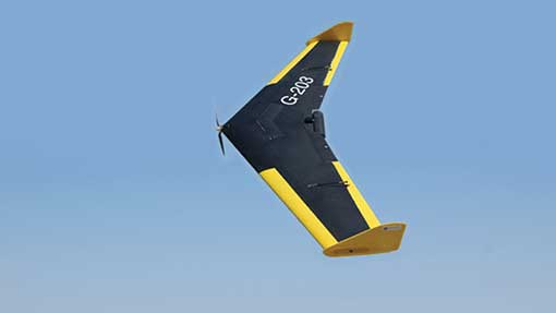
See also: Drone cuts costs on New Zealand sheep farm
Using the imagery as well as remote-sensing expertise, Ursula is then able to apply agricultural knowledge to develop complex matrixes and algorithms that translate this data into usable maps for use with common farm management systems.
Ursula is itself a service provider to farmers and crop protection specialists, and is at the forefront of both drone sensor and imaging platform development. This allows the company to supply agricultural data and measurements across a vast number of different crops, explains Mark Jarman. “We also liaise with the respective legislative bodies to try and sort out the legalities involved.”
Ursula is developing an owner-operator drone that will be able to offer contractors a way of providing the service to their customers. It’s hoped this will be available in the next six to twelve months.
“One route we are thinking of offering is a package that contains the UAV and sensor technologies that will allow the user to collect the imagery and data.”
“This would then be sent to us and we would then apply our algorithms and analytics to turn the imagery into agricultural data.”
Data collected by Ursula’s drones includes crop vigour, weed distribution and identification and more legislative-driven information such as field boundaries and cross-compliance data.
Legislative challenges
But there are hurdles to overcome in relation to both licensing and capturing data at a suitable quality, he adds. “Anyone can buy a drone, but it’s being comfortable that those we sell to have the appropriate licences and training to operate them that is the crucial factor. In terms of liability, we need the system to be bullet-proof in order to start supplying farmers or contractors.”
The licensing surrounding drones is notoriously complicated, and somewhat prohibitive in that it dictates operators need a level of certification that is both time-consuming and expensive to achieve.
“Farmers who buy a drone and operate it for purely non-commercial means are not under the same restrictions as those who are using it to increase their bottom line.”
“Anyone can buy a drone, but it’s being comfortable that those we sell to have the appropriate licences and training to operate them that is the crucial factor. In terms of liability, we need the system to be bullet-proof in order to start supplying farmers or contractors.”
Mark Jarman, Ursula Agriculture
For those offering a service, such as a contractor for example, and using the information gathered by the drone for commercial benefit means they would have to obtain the appropriate aviation qualification. Another grey area is the particular certificate required. In some instances, a notoriously-expensive commercial pilot’s licence is required.
Ursula drones are able to fly both higher and further than many other service operators – as high as 1000ft and as far as 1000m – in comparison to 400ft and 500m, adds Mr Jarman. “This is purely down to the licenses our operators have, as many have an ex-military background and have been through the appropriate training.”
The company is seeing an increase in demand for mapping and quantifying areas of weeds, disease and crop stress, which can lead to more effective herbicide application, targeted variable rate drilling and seed rate, improved variety selection and selective harvesting.
For those with significant blackgrass problems, this has become a popular service, says Mr Jarman.
“The cost of having images taken largely depends on the total hectarage covered. For example, for covering an area of 150ha or more to establish blackgrass burden, the cost would be between £10 to £15/ha.
“If you just want aerial photography, there are plenty of companies that offer this at a fraction of the price. But it’s the sensors, systems and imaging platforms that allow Ursula to deliver data at over five times the resolution of existing sensors.”
The company recorded more than 1.4m ha of data in 2013 and reckons that the more it covers, the more affordable it will become. And for contractors, as more and more farmers adopt this method of targeting inputs, the more viable this service might become.
