Learn more about drones and their benefits at Cereals
There is increasing interest in using unmanned miniature aircraft to monitor crops and this is being reflected at this year’s Cereals event as farmers and agronomists launch crop surveying technology into the air at an increasing rate.
Would-be users of “drones” can see a multi-rotor helicopter in action for the first time and get their hands on the controls for a have-a-go session
Farm management company Velcourt will have an exhibit setting out research into the potential for aerial information gathering on the farms it manages.
See also: How to stay legal when flying drones over arable crops
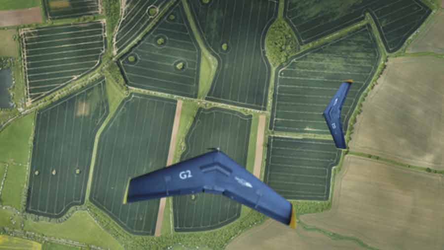
Drone manufacturer senseFly will introduce a new sensor for the eBee Ag fixed wing UAV at the event, Trimble will likely feature its UAV among a range of precision farming products, and Airinov will be present to explain its drone-based fertiliser recommendations service.
A notable absentee is Ursula Agriculture, a pioneer of drone-based aerial sensing services for arable farming, which it is understood will soon cease to trade after a managed winding-up of the business.
Improved margins
In a survey carried out last year, the company found that the farmers, agronomists, researchers and agricultural input suppliers who responded – 55% of whom said they either own or operate a drone in their business – identified improved margins as the most attractive benefit of successfully using aerial surveying technology.
Reducing input costs, improved understanding of field performance and variation and targeting inputs and management were also among the top-ranking benefits noted.
Ursula drone technology in action ©Ursula-Agriculture
While satellite imagery, analysis and fertiliser recommendations – such as the service offered by exhibitor SOYL – is well established, French company Airinov believes UAVs provide efficient aerial sensing for its nitrogen recommendation service, currently available for wheat and oilseed rape.
No model aircraft flying skills are required – which will be a disappointment to some – just an ability to create a field flight path using control software on a tablet computer to capture images that provide the required data for interpretation.
In addition to supplying its fertiliser service, Airinov is a re-seller for the eBee Ag fixed wing UAV produced by Swiss company senseFly, which at the event will introduce a new sensor for the craft.
The Sequoia is claimed to be the smallest, lightest multispectral sensor available for this application, capturing crop images across four highly defined, visible and non-visible spectral bands, plus RGB colour imagery.
It will enable users to collect more crop data than before, over much larger areas than multi-rotor drones can cover, says the company, with the option to capture visible imaging at the same time as analytical data if required in the same flight.
Users of the eBee-02 and -03 versions can upgrade with the Sequoia sensor, which despite its abilities will cost significantly less than existing multispectral UAS sensors, says senseFly.
Drone zone
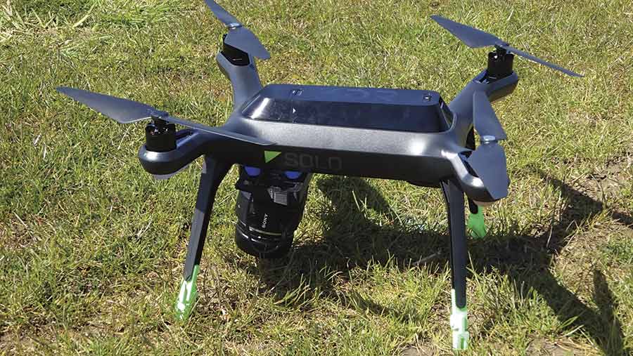
Farmers who want to get hands-on with a drone will have their opportunity by booking a session (via the event website) with G2way, a geospatial development company running the AgHawk “Drone Zone”.
The AgHawk is a regular production quadcopter (the 3DR Solo) that the company modifies and equips with different cameras for its role in agricultural aerial surveying and data capture.
It can be used for taking videos and oblique imagery or for mapping to produce both visible and NDVI maps of entire fields, controlled by an Android application running on a smartphone or tablet computer.
Typical flight duration for the UAV is 15 minutes, with Civil Aviation Authority restrictions on drone operation generally limiting the area that can be surveyed in each flight, says the company.
G2way plans to demonstrate how farmers and agronomists can now operate their own drones, without too much training or expense, and upload collected data via the Internet, processed on a Cloud computer, and then accessed via a web-based mapping portal.
A section of Velcourt’s exhibit will cover research on the potential of drones for improved management of crop disease.
It is working with BASF and Hummingbird on the project, exploring whether cost-effective aerial surveying can detect disease before symptoms become visible, identify different diseases and quantity the amount of any disease present.
All of which could help inform decision-making on fungicide treatment product choice, rate and timing, and achieve new levels of attention to detail in agronomy management.
The system allows users to manage spatial farm data such as soil sampling, yield mapping and variable rate map production, and the new version takes advantage of the wider availability and lower cost of Earth Observation (EO) data to develop this effective online tool.