Precision weed control can help save cash
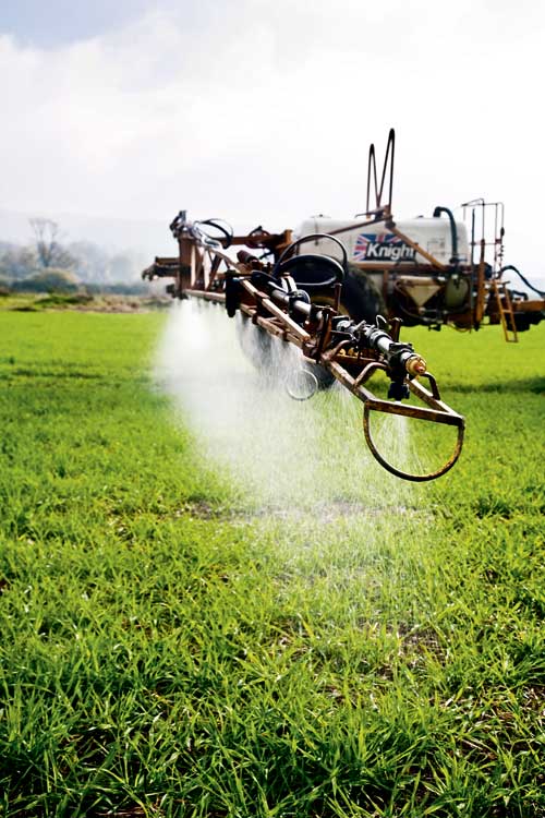
Weed control is a costly business. Herbicides are generally blanket-applied at rates capable of killing the largest weed in the field while lower doses can often suffice for most of the field.
Financially, there is clearly room for improvement, but with increasing pressure to improve pesticide stewardship there are environmental implications, too.
So a system capable of applying full rates on dense weed patches and reduced rates where few or no weeds exist is likely to win favour among farmers and environmentalists alike.
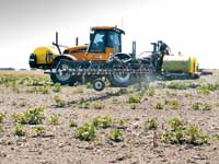
Scientists at Reading University, with support from various commercial partners, are developing a tool to do just that. Unlike systems that variably apply nitrogen in real time by sensing the crop’s nutrient content during application, rates are varied according to a weed map which is built up over time, says senior researcher Alistair Murdock.
Weeds generally appear in patches so the system identifies these zones and presents them on an application map, he says. “The farmer can then decide the extent to which rates are adjusted in low weed pressure areas.”
For example, when applying Atlantis (mesosulfuron + iodosulfuron) to control blackgrass the risk of lowering rates where there are small blackgrass populations may be too great, he acknowledges. “So it’s up to the farmer to make that choice.” Equally, the braver operator could drop rates to zero in areas with no weeds if they wish, he adds.
The system dectects weeds via a camera mounted on the cab of the combine, sprayer, or tractor carrying out fertiliser spreading duties. During these operations it captures images of the weeds at different stages of development and produces a weed map. “We want to interfere with field operations as little as possible when capturing the information,” says Dr Murdock.
 |
|---|
It taps into existing variable rate technology and can be used on full-size commercial sprayers with little modification. It won’t offer the grower higher levels of weed control, but it will save money as you only spray the areas that need it, he says.
Because the camera is linked to the tractor’s GPS system it is capable of producing geo-referenced weed maps plotting the exact location of problem areas. The map can then be loaded into a variable-rate enabled sprayer and doses will be automatically adjusted as the sprayer passes through weed patches. “For example, quarter rates could be used where there few weeds and full rates in weedy areas.”
A working prototype has been produced, but the weed identification software needs some refinement, he admits. “It does work, but we need to improve the success rate of identifying weeds.”
Identification is largely down to recognising the shape of the plant – the camera picks up the weed’s outline and uses an algorithm to recognise it as a particular species, he says.
But the time at which weeds can be accurately identified differs between species so accuracy is improved by combining information from images captured at different times, he says. For example, blackgrass identification is most accurate between spike emergence and seed fall while wild oats are easiest to spot from panicle emergence to harvest, he explains. “Accuracy will also increase as the algorithm is developed and more spacial, temporal and expert local knowledge is added.”
It is likely to be several years before the product is commercially available, but when it does come to market it’s likely to be marketed through a sprayer manufacturer or agronomy firm, he says. “A commercial version would be portable allowing growers to switch the product between machines.”
Australian precision cuts costsSpot-spraying weeds out of fallow ground is helping Australian grower David Brownhill cut herbicide costs by $100,000 a year. His 27m John Deere 4720 self-propelled sprayer is fitted with a Weedseeker spray system which only applies chemical to green weeds. As a result, the system doesn’t allow him to spray weeds out of a crop, but he can wipe out weeds in fallow ground. “We have long fallow periods in Australia due to our erratic climate, so controlling weeds between crops is extremely important for us.” Although fallow periods are shorter in the UK there are still opportunities for growers to control weeds in stale seed-beds or fallow ground between a winter and spring crops, he says. The only downside is that the system is expensive so you need to spray a large area to make it worthwhile, he says. “However, there are excellent environmental benefits too.” The Weedseeker system detects plants via a chlorophyll-detecting sensor attached to each sprayer nozzle. As the sprayer passes over a weed, the relevant sensor detects it and opens the nozzle to apply the product. Adopting this approach in favour of spraying the entire field has reduced his herbicide use by 80%. Although the system was a substantial investment, it paid for itself in the first year of use. “We are saving $100,000 (£55,500) a year, on average, and there are significant time savings too – a 3200-litre tank lasts all day when spraying 10% of the area, he says. “We’ve saved a total of $506,000 (£280,000) since we purchased the Weedseeker and we’ve been able to use tank mixes that were previously uneconomical. This has been particularly useful when spraying hard-to-kill weeds,” he says. The sensitivity of the Weedseeker sensors can be adjusted so that expensive products are only sprayed on larger weeds, he says. “We also have a separate spray line on the boom so glyphosate can be blanket applied to the whole field to take out smaller pests.” |
|---|
Manual weed mapping saves time
Mapping weed areas on a hand-held computer while crop-walking can save time and improve accuracy of crop recommendations, says Martyn Cox of Blackthorn Arable.
Trying to pinpoint weed patches in a large arable field is a tricky business; the patch may be in the same place year-on-year, but finding that spot quickly can take considerable time, he says.
To get over the problem he invested in a hand-held computer with GPS which he uses to create detailed maps of weed zones. “To start with I plot the field by driving around the margin. Then as I walk the field I can record where patches of weed appear within the field.”
The Farmworks software he uses is capable of adding multiple layers, so weed populations can be monitored from year to year. It’s fantastic for recording blackgrass populations, he says. “You can spray and as you know exactly where the populations are. You can go back into a standing crop and see how effective the product has been. You can focus on a problem area and go back time and time again to see if your treatments are working.”
Further informationReading University – www.reading.ac.uk Blacthorn Arable – www.blackthornarable.co.uk Weedseeker – www.ntechindustries.com |
|---|