
Sam-Dimension provides ultra-accurate weed maps for sprayers
 © Sam-Dimension
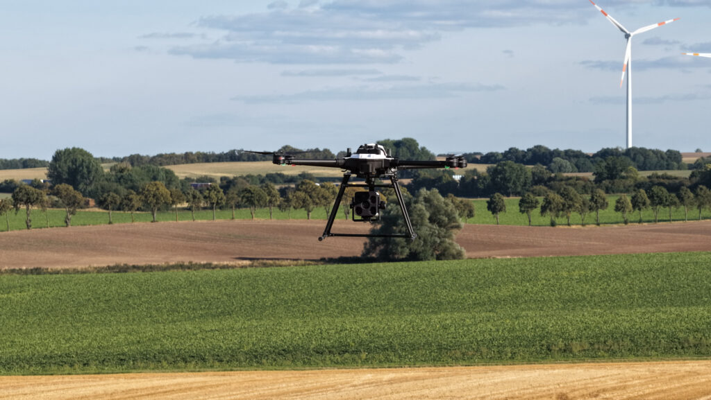
 German ag-tech company Sam-Dimension is bringing its “ultra-high resolution” weed detection system to the UK.
Its quadcopter drone can cover 1ha/min along a planned flightpath, with images captured at sub-2mm resolution and processed on board using Edge artificial intelligence.
See also: SoilEssentials’ Skai spot-sprayer cuts chemical use in pastures
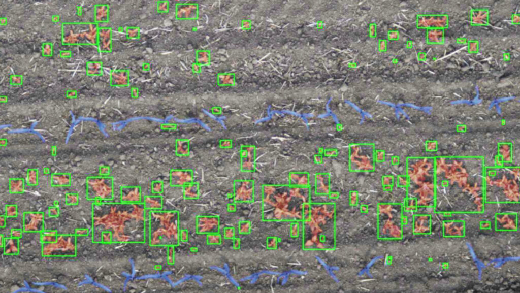
Further data crunching takes place post-flight to pinpoint any weeds – typically from the cotyledon stage onwards – and, within 24 hours, generate Spot-Spray maps.
These can be loaded onto any Isobus-compatible sprayer with section control, without the need for additional hardware.
© Sam-Dimension
This allows operators to switch from blanket to targeted herbicide applications where there are clear patches of weeds.
According to the company, taking this approach can reduce chemical usage by up to 90% and it’s relatively easy to plan for, since spray volumes are known in advance.
The on-board Sam-Cam AI camera system is currently trained to detect docks in grassland and broadleaf and grass weeds in cereals, oilseed rape, peans and beans, maize, sugar beet and several veg crops.
Species-specific blackgrass mapping is currently in development.
The technology is already being used across continental Europe and British growers will get their first chance to assess its merits at Cereals in June.
