More accurate and detailed soil mapping is on its way
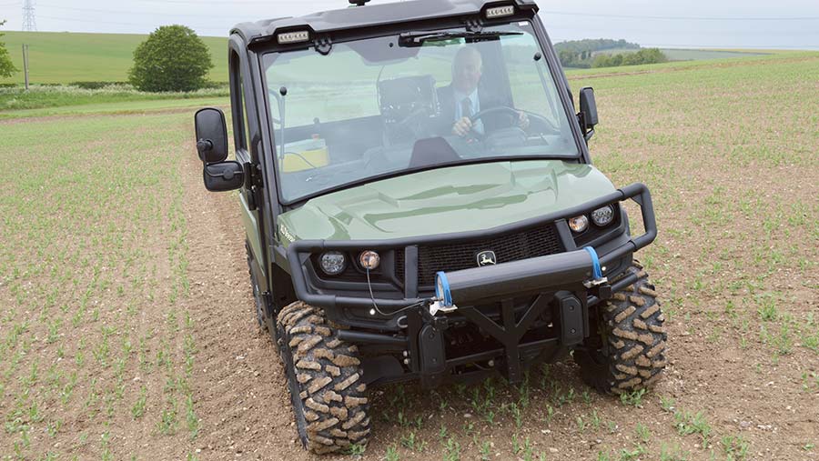 Mapping vehicle
 Soil nutrient mapping is set to get a lot more accurate and detailed as the scanning technology used for detecting minerals from the air in Canada is being adapted for the UK farm.
A helicopter-mounted sensor used for mineral prospecting has been scaled down to a high-definition soil scanning system which is being launched as TerraMap to refine precision farming systems.
The system is made by Canadian group SoilOptix, and has been used for up to 30 years in mineral prospecting and eight years in farming in North and South America and China.
The sensor measures gamma radiation, which comes naturally from the soil and it gives measurements of a range of criteria from phosphate and potash content to minor nutrients through to organic matter.
See also: High-tech soil scanner delivers margin-boosting data
The agronomy group Hutchinsons has exclusive use of this technology in the UK, which could mean cheaper and more accurate soil mapping over the long term compared with current scanning methods that use electro-conductivity measurement to give nutrient data.
Improved yield and lower costs
From the company’s trials last year, the new technique can lead to improved yields and help lower the overall cost of production, and is in use this season by a handful of farmers from Kent to the Scottish Border.
“This system offers greater accuracy than ever before and will offer benefits at least as good if not better than before,” says Oliver Wood, the group’s precision technology manager.
This new method is not affected by soil moisture, compaction, or crop cover, so can be used over a wider window than before, with the only limitation being not to use the scanner in heavy rain.
It could well replace current zonal scanning systems – where the accuracy can be affected by changes in soil moisture and soil compaction – and also grid sampling, which only samples chosen points.
The new system is set to be offered at two prices. The premium offering takes 21 measurements and costs £32/ha while the standard offering measures nine criteria at £24/ha, compared with current zonal scanning at £20-22/ha.
Collecting the data involves first scanning the soil by driving a lightweight all-terrain vehicle fitted with the sensor over the field at 10-12m widths, and then taking a soil sample every 3-4ha to calibrate the readings.
Data integration
The data can be fed into precision farming system, such as Hutchinsons’ Omnia, often leading to growers using variable drilling rate and variable phosphate and potash applications.
This system has been used over the autumn and spring across 60-70ha of the 5,000ha-plus arable cropping at Thurlow Estates on the borders of Suffolk, Cambridgeshire and Essex.
Here, manager Andrew Crossley has seen some questionable results in the past from chalky soils and soils that have seen big changes in structure.
Using current scanning systems, chalky soils can hold on to moisture that can affect readings and soil compaction can also cause some mixed results.
Jim Woodward, agronomist on the estate, says precision farming has been used on the farm over the past five to six years and a particular problem has come with scanning on chalky soils, so this new method could offer a solution.
“We now have the breath and depth of information in one place to allow us to target inputs to give a better return on investment,” says Mr Woodward, who works for Farmacy, which is a member of the Hutchinsons group of companies.
TerraMap premium service measures the following 21 criteria
(The standard service includes only the first nine measurements)
- Phosphate
- Potash
- Magnesium
- pH
- Clay %
- Sand %
- Silt %
- Soil texture
- Elevation
- Calcium
- Manganese
- Sodium
- Boron
- Copper
- Molybdenum
- Iron
- Zinc
- Sulphur
- Organic matter
- Cation exchange capacity (the ability of soils to hold nutrients)
- Plant available water index