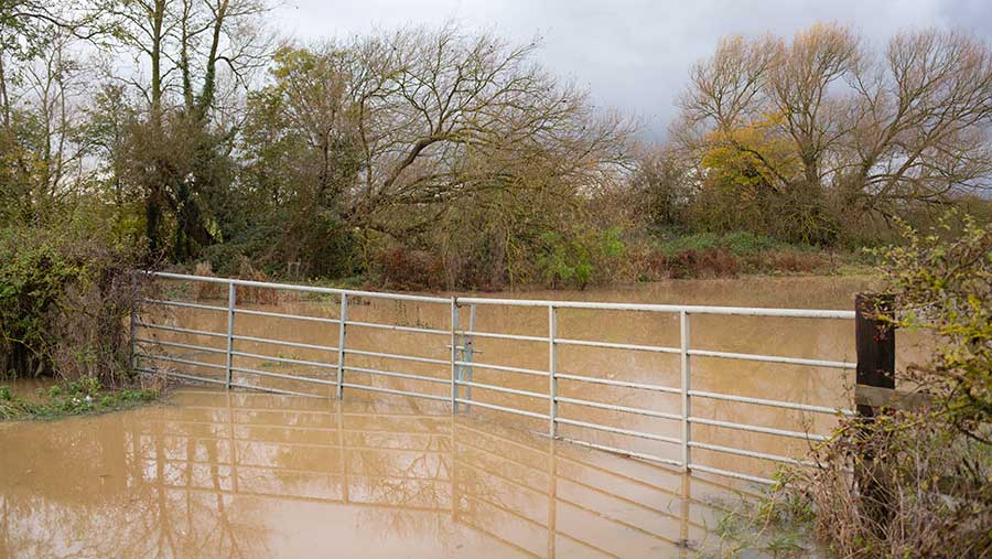
What UK farmers should expect from weather trends
 © Tim Scrivener
 Farmers have been hit hard by extreme weather events over the past few years and the trend is likely to continue, scientists predict.
Met Office forecasters have concluded that on average the UK will face milder, wetter winters and hotter, drier summers in the long term due to global warming.
The findings are set out in the latest UK Climate Projections 2018 (UKCP18) document, published in September last year, which uses climate model projections to give estimates of future climate outcomes.
See also: How extreme weather has hit UK and European potato yields
A range of future climate scenarios until 2100 are covered based on different rates of greenhouse gas (GHG) emissions into the atmosphere. These update existing emissions scenarios published in UKCP09.
Speaking to Farmers Weekly, Met Office forecaster Ailsa Barrow, outlined three key messages for UK climate and farming from UKCP18:
- Drought/hotter summers
- Changes in frequency/intensity of rainfall events
- Low-lying areas may see an increase in sea levels
She explained: “The hotter, drier summers will tend to focus on Kent, the South East, and East Anglia where these areas will likely see a greater difference in the temperature increase rather than in the North and in Scotland.
“The South East and East Anglia will rely on winter rainfall coming in to restock the groundwater. Summer rainfall will tend to be characterised by short, heavy convective precipitation.”
Total rainfall from extremely wet days increased by 17% in the decade 2008-2017 for the UK overall, compared to the long-term average.
Intense rainfall
Farmers will likely have to contend with an increase in the frequency and intensity of convective rainfall, a pattern which has become more prevalent in recent years.
“Rainfall will become more intense and there will be a lot more surface water and erosion,” said Ms Barrow.
Hot summers are expected to become more common, but new data in UKCP18 suggests future increases in the intensity of heavy summer rainfall events.
Agriculture would be wise to examine these key findings to try to understand the shocks and benefits for the industry, Ms Barrow noted.
Met Office climate scientist Mark McCarthy compiled the 2018 State of the UK Climate report, the fifth report in the series.
The data shows that since 1884, all of the UK’s 10 hottest years have occurred since 2002. Between 2009 and 2018, the average temperature across the UK was 0.9C warmer than the average for 1961-1990.
None of the 10 coldest years have occurred since 1963, although 2010 was an exceptionally cold winter.
Warmer and wetter
The UK is getting warmer, but also wetter, with 13% more summer rain compared to the last century. And with global GHG emissions set to rise, scientists predict hot summers could become more common, near to 50% by 2050.
Dr McCarthy said the UK had been experiencing a recent cycle of drier Junes and wetter Augusts. Only 2013 saw a hot August in recent years. Catchy weather in August was shortening the window for farmers to harvest their crops, he added.
“The general picture is a warming trend and an increase in the growing season,” said Dr McCarthy.
Finally, recent decades have seen 15% fewer ground frosts compared to 1961-1990. “Ground frosts haven’t vanished, but there are fewer than there used to be,” he added.
Web tool maps emerging agricultural pests
Scientists have created a web tool which uses climate data to map the estimated emergence dates of different pests across the UK.
Developed by the Met Office Hadley Centre in collaboration with Defra’s plant and animal health team, the tool helps users to identify areas of the UK at highest risk of a particular pest.
By applying knowledge of known temperature thresholds for different pests, alongside historic climate records, users can assess when specific pests are expected to emerge in areas across the UK.
It is hosted by Fera Science
Supercomputer gives more accurate forecasts
The Met Office is consistently recognised as one of the top two most accurate operational forecasters in the world, according to the World Meteorological Organisation (WMO).
For example, its four-day forecast is now as accurate as its one-day forecast was 30 years ago. Around 215bn observations are received at the Met Office every day from satellites, radar, weather stations, ocean buoys, weather balloons and ships.
This data is fed into one of the world’s most powerful supercomputers – the Cray XC40 – which is capable of 14,000trn calculations per second, which enables more reliable weather forecasts.
Met Office deputy chief meteorologist Matthew Lehnert said: “The accuracy of our models has increased vastly over the past 30 years, but the expectation to get ever more accurate forecasts almost to your doorstep has grown with it.”
But there is still room for improvement. For example, forecasting snow is always a challenge because the UK is on the boundary of a relatively cold air mass, but surrounded by relatively warm seas which can often keep temperatures up.

