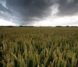
Farmers on flood alert as heavy rain returns

Dozens of areas in the UK have been placed on flood alert as torrential rain and high winds are set to batter the UK over the next 24 hours.
Heavy downpours and gale force winds up to 60mph are expected in the north of England and south of Scotland.
The Environment Agency has issued 94 flood alerts and 20 flood warnings, mostly in south-west England, and said further warnings were likely to be issued for river and surface water flooding.
The Met Office said some areas could see up to 80mm (3ins) of rain for parts of the South West, South East, Midlands and North East over the next 48 hours.
Peter Sands farms 1,500ha in partnership with his parents at Ivy Dene, Brewood, Staffordshire.
He said: “We have drilled 400ha of oilseed rape and 400ha of wheat, which has gone in very well, but now we are at a standstill.
“It’s too wet for ploughing, too wet for cultivations and too wet for drilling – we won’t doing much sowing this week.
“Hopefully, we will get going again at the end of the week. It does tend to dry out quickly at this time of year.”
“It’s too wet for ploughing, too wet for cultivations and too wet for drilling – we won’t doing much sowing this week.”
Peter Sands
Dairy farmer Rob Harrison, from Greystone Farm, in Blockley, Moreton-in-Marsh, Gloucestershire, said on Twitter: “40mm plus and still going strong, 2012 give us a break #sosfarming.”
Farmers in the South West and South East were urged to prepare for possible flooding on Monday (24 September).
Significant disruption, including to travel and flooding of properties and communities, is possible.
And strong winds will increase the risk of flooding as wind-blown debris has the potential to block watercourses and drains, the Environment Agency said.
David Jordan, director of operations at the Environment Agency, said: “We strongly urge people to sign up to flood warnings, keep a close eye on local weather forecasts and be prepared for the possibility of flooding.
“We also ask people to stay safe, by staying away from swollen rivers and not attempting to drive through floodwater.”
Steve Willington, Met Office chief forecaster, said: “A deep area of low pressure is moving north from the Bay of Biscay and will bring a very unsettled spell of weather to all parts of the UK this week.
“Everyone should be prepared for the effects of heavy rain and strong to gale force winds as they combine to bring the potential for travel disruption and localized flooding over the next few days.”
Add your pictures to our Wet Weather gallery

